Arkansas Highway 23 may only stretch 19 miles between the Mulberry River bridge and tiny Brashears, yet riders speak of it with the kind of reverence usually reserved for alpine passes.
Steep pitches, hair‑pin corners, and forested corridors that feel like green tunnels combine for a ride that’s equal parts workout and postcard.
Throw in a riot of dogwoods in April or a blaze of maples in late October and there’s little wonder the Pig Trail has become a bucket‑list line on southern cycling maps.
If you’re plotting a spin through the Ozarks, check out my guide below, which lays out exactly what to expect and how to make every mile count.
Why the Pig Trail Steals Riders’ Hearts

Cut across the Boston Mountains and you’ll find scenery that shifts from sandstone cliffs to fern‑lined creek beds in minutes.
Motorcyclists discovered the route decades ago; cyclists soon followed, lured by a perfect blend of gradient and quiet pavement.
Official scenic‑byway status arrived in 1989, locking in protection for the lush forest canopy that often arches overhead like living architecture.
Because the corridor sits inside Ozark National Forest, commercial sprawl never took root—so gas fumes, billboards, and fast‑food wrappers stay out of sight.
Reasons Riders Keep Coming Back
- Compact challenge: Only 19 miles, yet more than 1,100 feet of vertical gain on the signature climb.
- All‑season appeal: Wildflowers in April, swimming holes in June, crimson sugar maples in October.
- Low traffic: Car counts average a fraction of busier state highways, giving you room to pick your line on tight corners.
- Culture hit: Historic towns like Ozark and Fayetteville bracket the ride, supplying post‑ride coffee or a craft beer without forcing chain restaurants on you.
Mile‑by‑Mile Highlights
View this post on Instagram
| Mile Marker | Elevation Change | What You’ll See |
| 0 (I‑40 junction) | Gentle roll | Mulberry River bridge, anglers casting for small‑mouth bass |
| 3 | Steady rise | Dense hardwoods, spring dogwoods |
| 5 | +300 ft | First hair‑pin, rock bluffs on right |
| 8 | Plateau | Pig Trail Falls turnout—short hike rewards with mist‑cooled face |
| 12 | +400 ft | Deep “leaf tunnel” section, occasional view toward Boston Mountains |
| 15 | Short descent | Break in trees opens to layered ridgelines—prime photo stop |
| 19 (Brashears) | +150 ft kick | Highway 16 intersection; rustic store with cold drinks |
Climb Snapshot
| Metric | Details |
| Distance | 4.3 miles |
| Elevation Gain | 1,166 feet |
| Average Grade | 4.9 % overall — 5.9 % on ramp sections |
| Starting Point | Fane Creek bridge |
| Top Out | Scenic overlook pull‑off |
Grades rarely spike above double digits, yet curves limit momentum, so settle into a rhythm rather than chasing speed.
Season‑by‑Season Riding Guide

Spring (March–June)
Mornings hover around 55 °F, and creek crossings thrum with snow‑melt runoff. Redbuds splash pink across otherwise lime‑green ridges.
April and early May offer the best mix of cool air and long daylight windows. Expect the occasional thunderstorm; carrying a light rain shell matters more than aero socks.
Summer (July–August)
July bakes the pavement to 100°F and humidity rivals a sauna. If summer travel is unavoidable, alarms set before sunrise let you reach Brashears by noon while shade still blankets most corners near the crest.
Finish the day with a plunge into the Mulberry River; locals swear its spring‑fed pools drop core temperature faster than any sports drink.
Fall (September–November)
From late September to Halloween, the Pig Trail morphs into a corridor of scarlet sweetgum, golden hickory, and pumpkin‑orange oak.
Camera crews flock here during that five‑week window, yet motor traffic remains civil. Average highs brush 70°F; mornings dip to flannel‑weather 45°F, and visibility stretches clear across Boston Mountain layers.
Winter (December–February)
Shaded hair‑pins hide black ice after every snow dusting. The Forest Service doesn’t prioritize plowing on scenic byways, so riders risk mile‑long stretches of packed sleet. Most local clubs shift training routes south toward warmer valleys until March.
Bike and Kit Recommendations

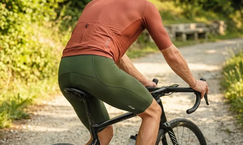
A standard road frame with 28 mm tires handles the tarmac easily; however, gearing selection decides whether you’ll smile or grimace on the 5.9 % pitch.
Compact cranks (50/34) paired with at least a 32‑tooth cassette give flexibility when legs feel toasted at mile 18. Disc brakes earn bonus points on wet leaves.
Planning to sample adjacent gravel detours—like dirt spurs off Morgan Mountain Road? Swap to a gravel bike with 37 mm rubber and low‑pressure tubeless setup; chunky limestone lurks in shaded gullies.
Layers matter. Ozark weather swings 30 degrees between valley floor and ridge line. A packable gilet plus arm warmers weigh almost nothing yet save the ride if a cold front rolls in sooner than forecast.
Plan for Remote Miles
A quick service stop doesn’t exist once you roll north of the Mulberry River. Self‑sufficiency keeps uncomfortable surprises from turning into emergencies.
| Item | Recommendation |
| Water | 2–3 L in bottles or hydration pack; add a filter straw for creek refills |
| Calories | 60–90 g carbs per hour—chews, stroopwafels, or homemade rice cakes |
| Communication | Spotty signal; Garmin InReach or similar satellite beacon |
| Tools | Tube, CO₂ or pump, tire boot, multi‑tool with chain breaker |
| Weather kit | Ultralight shell, warm gloves October–April |
| Maps | Offline GPX on head unit plus paper backup |
Local clubs advise riding in pairs, both for morale on the steeps and for quicker aid if somebody over‑cooks a corner.
Road Status Check: Before leaving home, pull up ARDOT’s live lane‑closure map on IDriveArkansas; wash‑outs and rock slides occasionally force rolling closures.
Stringing Together Bigger Adventures
Nineteen miles barely whets appetites for endurance riders, so many tack on extra loops:
- Highway 16 Roller Coaster: From Brashears head west toward Fayetteville, dipping through War Eagle valley and its 1870 iron bridge. Adds 33 miles and 2,200 feet of gain.
- Ozark Highlands Trail Teaser: Push a gravel bike four miles east to single‑track at Ozone campground. Ride as far as spirits allow then glide back on tarmac.
- Mulberry River Loop: Drop to the town of Ozark, refill bottles, then climb back via Highway 352—a figure‑eight of about 65 miles and 4,000 feet of vertical.
Camping in the forest? Redding Recreation Area sits one mile west of Highway 23 on Forest Road 1003, offering tent pads, potable water, and quick access to river swimming.
Cabins near Cass supply a roof plus evening camp‑fire chat.
Community Connections & Logistics
Northwest Arkansas brands itself the mountain‑bike capital of America, boasting more than 550 miles of single‑track. Roadies benefit from the same cycling‑mad culture.
- Ozark Cycling Adventures publishes weekly bikepacking ride plans, gear reviews, and GPX files.
- OZ Cycling Tours curates custom itineraries; guides will haul luggage so your bike stays feather‑light.
- Shops: Phat Tire in Fayetteville and Turner Bend near Cass carry spare tubes, cold drinks, and intel on pavement quality.
Razorback football weekends pack hotel rooms from Fort Smith to Fayetteville, so book early if your trip overlaps a home game.
Quick‑Hit Planning FAQ
- Parking? Turner Bend Outfitters, at the southern end, charges a nominal fee and keeps an eye on vehicles.
- Pets? Leashed dogs can accompany sag vehicles; wildlife makes free‑running pups risky.
- Best camera spot? The overlook near mile 15 captures late‑afternoon sun on layered ridges—bring a polarizer.
- Post‑ride toast? Core Brewing’s Springdale taproom pours an IPA called Pig Trail Pale, a celebration of well‑spent calories.
Historical Snapshot
Early settlers moved lumber and farm goods along wagon tracks that later became Highway 23.
Wild pigs roamed open ranges, and the road’s curly profile mirrored an animal’s tail, embossing the porcine theme well before Razorback football hype reinforced it.
Scenic‑byway status in 1989 preserved forest canopy and limited billboard encroachment, safeguarding the “leaf tunnel” effect riders rave about today.
Summary
Quiet pavement, stout gradients, and Ozark scenery worthy of a National Geographic spread: Pig Trail Scenic Byway delivers all three in under twenty miles.
Pack extra water, double‑check brake pads, and leave room in the schedule for photo stops. The climb will sting; the views will soothe; and long after Strava kudos fade, memories of sugar‑maple skylines and river mist will lure you back for another spin.