Atlanta rewards riders who plan. Real trail networks exist, long enough to fill a morning or a full day. At the same time, route choice matters because traffic speed, sketchy crossings, and low-visibility connectors can turn a calm ride into a stressful one fast. A smart plan keeps the good parts front and center and trims away most surprises.
Below sits a practical guide to the strongest Atlanta e-bike routes, plus a field-tested way to avoid risky areas without guessing, stereotyping neighborhoods, or relying on vague reputation.
Start With The Real Risk – Traffic And Crash Exposure
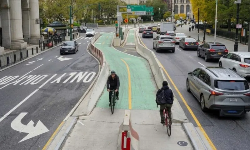
Most problems on an Atlanta e-bike day come from cars, intersections, and high-speed arterials, not from random street drama. State crash data points to a clear pattern. About 60% of bicyclist crashes occur at intersections.
Hospitalization and emergency room visit charges tied to bicyclist injuries total $68 million, with separate categories for motor vehicle traffic and non-traffic crashes.
Atlanta also runs a Vision Zero crash dashboard that can be filtered by mode, severity, time, and location. It shows repeat-problem intersections and corridors that punish cyclists year after year.
Serious injury incidents tied to shared-ride services have also triggered nationwide legal action, including large-scale claims now grouped under the Uber Lawsuit.
Local metro reporting adds a critical detail: many pedestrian crashes happen close to transit stops, which matters for first-mile and last-mile planning.
Practical takeaway: treat intersections as the main hazard, then design rides that reduce the number of risky crossings.
What Counts As An E-Bike In Georgia, And How Atlanta Tends To Enforce
Georgia defines three electric-assisted bicycle classes in code.
- Class I and II cap assist at 20 mph.
- Class III allows pedal-assist up to 28 mph.
On shared-use paths around Atlanta, local reporting describes enforcement expectations that line up with Class I and II on crowded multi-use paths like the BeltLine. Higher-speed Class III units get pushed to roadways rather than packed trails.
Planning to rent through an app? Atlanta has a nighttime rental restriction for permitted shared dockless devices from 9:00 PM to 4:00 AM. Timing choices can affect route choices.
Quick Route Comparison
Atlanta BeltLine Eastside Trail
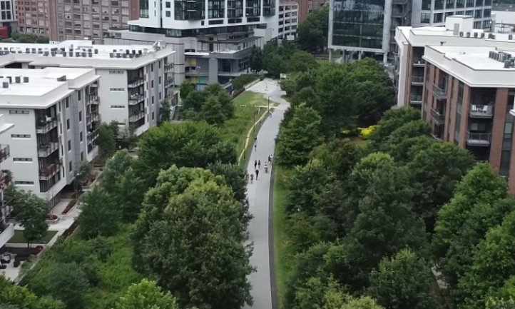
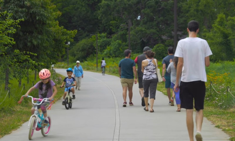
Atlanta’s most recognizable greenway mixes art, food stops, and nonstop foot traffic, so riding here calls for patience, low assist, and sharp attention at every crossing.
The Signature Ride With Shared-Path Realities
Eastside Trail is the ride most visitors picture first. Food halls, murals, markets, and constant foot traffic keep energy high. The BeltLine leans into a ride-and-explore vibe and pairs it with clear etiquette.
How to ride Eastside on an e-bike without becoming the problem
- Treat it like a busy promenade, not a training route.
- Keep assist low in crowded sections.
- Treat every crossing as a potential stop.
- Use a bell or a clear verbal call when passing.
- Expect unpredictable movement near markets, murals, and photo spots.
Best timing
- Weekdays: early morning works for a commute-style pace.
- Weekends: start earlier than planned, crowds build quickly.
Access planning
Use official access points rather than worn cut-throughs. Signage and sightlines tend to be better at formal entries.
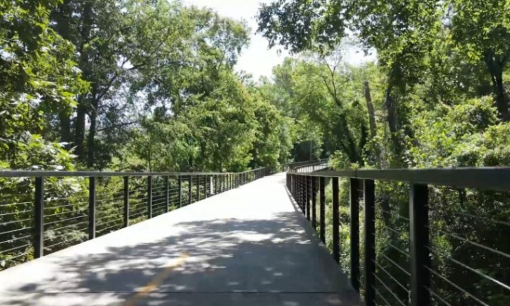
Atlanta BeltLine Westside Trail
Westside Trail offers longer, smoother miles on the west side of the city, with fewer crowd pinch points and a cleaner flow that suits relaxed e-bike cruising and steady-distance rides.
Longer Continuous Miles With Cleaner Flow
Westside Trail suits riders who want more continuous rolling and fewer stop-and-go moments than Eastside gets on peak days.
Local coverage in 2025 described a newly opened segment pushing the Westside Trail toward nearly 7 miles of continuous paved path, improving off-street routing on the west side.
How to ride Westside safely
- Plan crossings ahead. Even separated paths include intersections where driver attention can drop.
- Carry front and rear lights when riding near dusk, shaded segments get visually dark early.
- Keep speed reasonable near trailheads and parks where kids and dogs appear fast.
Proctor Creek Greenway
A short, practical greenway on Atlanta’s west side, Proctor Creek Greenway fits cleanly into transit-friendly rides that favor calmer miles and simple connections.
A Practical Connector With Transit-Friendly Access
Proctor Creek Greenway covers 2.44 miles and links well with Westside destinations. Major access points include Bankhead MARTA Station and Westside Park.
Why it works on an e-bike
- Easy to stack with Westside Trail and Westside Park for a 60- to 120-minute
- Transit access reduces parking hassle.
Safety playbook
- Use daytime hours for quieter segments.
- Check recent crime maps around station and parking access points using short date filters rather than general reputation.
PATH Stone Mountain Trail
A long, historic corridor that stitches central Atlanta to Stone Mountain Park, PATH Stone Mountain Trail offers one of the city’s most ambitious point-to-point greenway rides.
The Long Ride That Demands Planning
PATH lists Stone Mountain Trail at 19 miles as a historic core of the metro trail network. Trail directories may show a longer figure when counting connectors and on-street links. Both figures can be accurate depending on what gets counted.
How to ride it well
- Pre-load a route map. Wayfinding matters on connectors.
- Treat intersections as the main hazard because crash data clusters there.
- Build a bailout plan using MARTA since transit can carry bikes and many stations have bike storage and fix-it kiosks.
Add A High-Value Segment: Freedom Park Trail
Freedom Park Trail links neighborhoods and connects with Stone Mountain Trail at a midpoint. Shaded greenway miles and a calmer vibe make it a strong add-on.
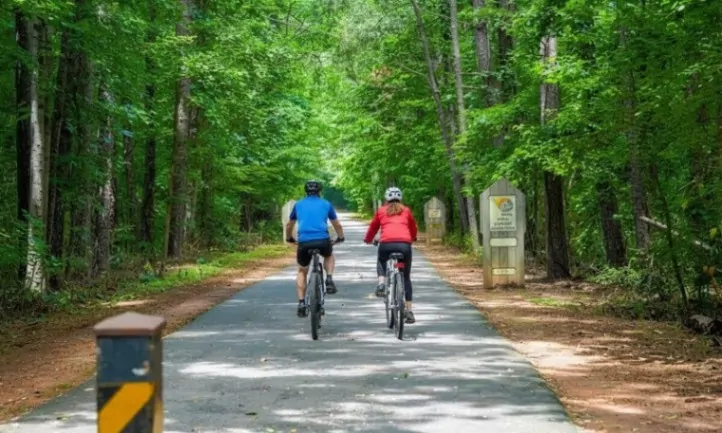
South Peachtree Creek Trail

A shaded ribbon of greenway tucked between neighborhoods and Emory’s campus, South Peachtree Creek Trail offers a quiet, nature-heavy break from Atlanta traffic.
Short, Scenic, And Slightly Technical In Wet Conditions
South Peachtree Creek Trail features a mile-long boardwalk through forest and wetlands, with links to parks and Emory University.
Boardwalk is fun. Boardwalk also punishes speed.
What to watch for
- Wet leaves and morning dew reduce traction.
- Pedestrians stop for wildlife and trains.
- Narrower width in places means passing needs patience.
Keep assist low and accept a slower pace. That choice prevents most near-misses.
Silver Comet Trail
Silver Comet Trail offers long, uninterrupted paved miles that feel built for steady e-bike cruising and relaxed distance riding.
The Best “Go Long” Option Near Atlanta
Silver Comet stands out for long-distance riding. It runs 61.5 miles from Smyrna to the Alabama state line, connecting to the Chief Ladiga Trail. The corridor is fully paved, generally 12 feet wide, well-maintained, and packed with access points.
How to ride Silver Comet smart
- Pack for distance even if planning a short out-and-back. Flats feel far out there.
- Bring a small repair kit: tube, levers, mini pump or CO2, and a multi-tool.
- Plan trailheads and turnaround points ahead, segments get remote.
- Watch road crossings and trailhead parking lots where car-bike conflicts cluster.
- Follow posted trail rules. Georgia defines e-bike classes, posted signage still controls on-site behavior.
Chattahoochee River National Recreation Area
Chattahoochee River National Recreation Area offers shaded riverside trails and open multi-use paths that suit relaxed scenic rides as well as steady fitness loops.
Scenic Miles With Shared-Use Crowds
River-focused rides cluster around Cochran Shoals and Palisades units. The park lists 7.11 miles of trails open to cyclists and emphasizes shared use.
How to avoid conflict
- Skip peak weekend late mornings when foot traffic spikes.
- Reduce speed on blind turns and near families.
- Expect runners wearing headphones and plan passes conservatively.
Big Creek Greenway
A paved corridor through North Fulton, Big Creek Greenway offers calmer mileage, wildlife views, and an easygoing ride away from the densest city traffic.
Lower-Stress Riding In North Fulton With A Catch
Explore Georgia describes an 8.2-mile paved, 12-foot wide path with wildlife viewing and basic amenities. The broader Big Creek concept spans 26 miles in multiple disconnected sections.
Planning note
Confirm which segment sits open and connected near an entry point. Disconnected sections can mean an unexpected car transfer.
How To Avoid Risky Areas Without Guessing Or Stereotyping Neighborhoods

A workable method focuses on data and infrastructure rather than vibes.
Use APD Crime Maps For Trailheads And Stations
The Atlanta Police Department offers online crime mapping and open data. Use it as a preflight check.
- Filter to the last 14 to 30 days.
- Look at trailheads, parking lots, and the 2 to 4 blocks around entry points.
- If clusters appear near a planned entry, pick a different entry rather than forcing the plan.
Use Crash Data To Avoid Streets That Punish Cyclists
Atlanta’s Vision Zero crash dashboard filters by travel mode and severity.
- Pick crossings with fewer severe crash histories.
- Avoid high-speed arterials as connectors when quieter parallel streets exist.
- Decide when a protected facility deserves a detour.
Regional reporting highlights corridors that repeat in fatality counts over multiple years. Planning routes that reduce exposure on corridors such as Memorial Drive, Covington Highway, and Tara Boulevard can lower risk when protected alternatives exist.
Treat Intersections As The Main Hazard
Crash data shows that bicyclist crashes cluster at intersections.
Intersection checklist
- Assume turning drivers do not see you.
- Cover brakes at every crossing.
- Use a visible lane position on streets, and avoid hugging the curb near right-turn conflict points.
- Cross in a straight line, avoid weaving between pedestrians.
Pick Time Windows That Reduce Risk
Safer windows
- Early morning or mid-morning on weekdays.
- Daylight hours on quieter greenways.
Higher-risk windows
- Dusk and late night, especially on low-visibility connectors.
Use MARTA To Avoid Hostile Road Connectors
Every bus carries racks for 2 bikes. Trains have room for bikes. Many rail stations offer bike storage plus fix-it kiosks, listed as 37 stations excluding the airport.
Practical application
- Ride greenway miles, then transit past hostile road segments.
- Use MARTA as a bailout when weather shifts or mechanical issues hit.
Build A Simple Personal Safety Protocol
Just basics:
- Share live location with 1 person on longer rides.
- Carry ID and a card or cash.
- Bring a lock for trailhead food stops.
- Use front and rear lights even during daytime.
- Keep a charged phone and a small battery for rides past 3 hours.
Sample Rides That Work Well On An E-Bike
Short on planning time, long on riding goals, the following sample rides give clear, low-stress ways to get real miles in Atlanta without overthinking routes or safety tradeoffs.
A 60- To 90-Minute City Sampler
Route idea
- BeltLine Eastside Trail at low assist with short spurs into nearby parks.
Goal
- Scenery and stops.
Safety focus
- Passing etiquette and crossing attention.
A 90- To 150-Minute Westside Loop
View this post on Instagram
Route idea
- Westside Trail segments plus a Proctor Creek Greenway add-on during solid daylight.
Goal
- Longer continuous rolling with fewer crowd pinch points than Eastside on peak hours.
A 3- To 6-Hour Distance Day
Route idea
- Silver Comet out-and-back from a chosen trailhead with a planned turnaround and fuel stop.
Goal
- Steady, car-free miles.
Safety focus
- Self-sufficiency and trailhead awareness.
Gear And Setup That Pay Off In Atlanta
- Tires: puncture-resistant casings handle debris on connectors.
- Lights: front and rear even for daytime rides.
- Bell: helpful on shared paths.
- Repair kit: tube, levers, pump or CO2, multi-tool.
- Hydration: shaded corridors still get hot.
Final Notes
Atlanta offers enough trail mileage to fill weeks of riding. Smart choices keep rides calm and predictable.
Focus on data, plan crossings, lean on greenways, and use MARTA to leap over hostile connectors. The result feels simple: more miles that feel good, fewer moments that spike the heart rate.