Mount Fuji is Japan’s tallest peak, a cultural symbol, and honestly, a bit of a show-off. Towering at 3,776 meters and surrounded by a patchwork of pristine lakes, forests, and winding asphalt, it also happens to be one of the most incredible places you can point your handlebars.
If you’re the kind of person who thinks cycling should come with panoramic views and a side of calf cramps, welcome.
Let’s run through the best road cycling routes around Fuji – painful climbs, scenic loops, and some peaceful backroads that’ll restore your will to keep pedaling.
Climbing Mount Fuji by Bike
Okay, so you’re here for the climbs. You’re not satisfied until your legs are trembling and your lungs are whispering why are we doing this? Cool. You’ve got options.
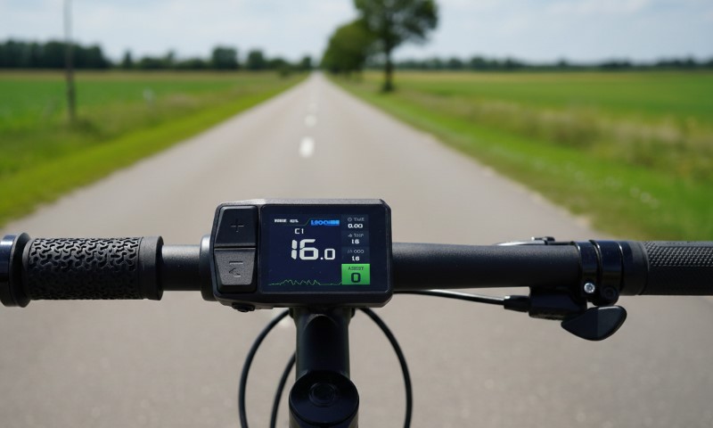
Staying Connected When the Altitude Hits
Quick pause from the climbing carnage: let’s talk about something way less glamorous but stupidly important: staying connected.
You’re riding up a mountain in Japan. Roads twist, weather flips, and sometimes your legs give out in the middle of nowhere. If your phone’s just a paperweight with a camera, you’re kind of stuck.
Having an eSIM that actually works everywhere makes a real difference. Not just the kind that gives you Instagram but the kind that comes with a real phone number.
Services like Mobal, for example, use networks that cover 99% of Japan’s population. That means you’ll still have a signal when you’re halfway up the Subaru Line.
It’s more than just map-checking or texting your ride buddy. With an actual number, you can do things like:
- Call a taxi if your derailleur decides to explode halfway up the mountain
- Order food or gear from local delivery services (because some apps just refuse to work on data-only eSIMs)
- Access local booking platforms and emergency numbers without awkward workarounds
It sounds small until it’s not. When the temperature drops at 2,000 meters and you’re out of energy and water, being able to actually call someone becomes kind of a big deal.
Just something to think about before you hit the slopes with nothing but wishful thinking and a half-charged phone. Now, let’s get back to these awesome cycling trails.
Fuji Subaru Line
- Distance: 15 km
- Elevation Gain: 1,480 m
- Average Gradient: 6-8%
- Traffic: Heavy on weekends, tourist buses love it
This one’s the crowd favorite. The Fuji Subaru Line is the main artery up the north side of the mountain. It starts gently enough near Lake Kawaguchiko, then keeps grinding until you reach the 5th Station at 2,305 meters.
The road is silky-smooth and well-maintained, which is great because the climb doesn’t pull punches.
Expect switchbacks, forest canopies, occasional Fuji views, and lots of waving at hikers. The 5th Station even has shops and toilets, pure luxury after sweating up nearly 1,500 meters.
But here’s the catch: weekends are chaos. If you hate sharing the road with sightseeing vans and rental cars, aim for a weekday early morning. Bring a jacket too. It gets real cold, real fast, once you’re up there.
Fujinomiya Line
View this post on Instagram
- Distance: 50 km (yes, five-zero)
- Elevation Gain: 2,300 m
- Steepest Sections:6% at one point, so… yeah.
- Traffic: Surprisingly light, but no food/water until the top
Welcome to your villain origin story. Starting from sea level near Fujinomiya, this brutal climb takes you all the way up to another 5th Station, because Fuji’s got several, like some kind of boss-level video game.
It’s Japan’s top-rated climb and the 40th most challenging globally. You’ll understand why when your quads stop working halfway through.
There’s a short shoulder for part of the route, but otherwise you’re hugging curves with mild traffic and zero places to refuel until you hit the top.
So unless you’ve got a personal support vehicle tossing you snacks like Tour de France soigneurs, pack supplies.
Why bother? Because climbing 2,300 vertical meters in one ride earns you lifetime bragging rights and a new respect for your legs.
Fuji Yoshida Line
- Distance: 14 km
- Elevation Gain: 1,360 m
- Traffic: Basically none (it’s technically closed)
Let’s be honest, this one’s a little rogue. The Fuji Yoshida Line is officially closed to cars, blocked by gates, and sprinkled with “no entry” signs. So naturally, it’s a favorite among local cyclists.
You climb quietly through forest roads, dodging pine needles and maybe a deer or two, until you link up with the Subaru Line and descend like a champion.
Is it legal? Questionable. Is it peaceful? Absolutely. If you’re cool with rule-bending and very minimal enforcement, this route is a hidden gem.
Reality check: Don’t be a jerk. Ride respectfully, don’t trash the place, and be aware you’re technically trespassing.
Scenic Lake Loops

Now for something a little less masochistic. The Fuji Five Lakes region is prime territory for scenic, low-stress rides. Think gentle slopes, crisp air, and constant Fuji eye candy.
Lake Kawaguchiko & Lake Saiko
- Distance: 32 km
- Elevation Gain: 150 m
- Stops: Ubuyagasaki (famous viewpoint), Kawaguchi Asama Shrine, Ohishi Park
- Traffic: High on weekends, manageable early mornings
This loop is the Instagram darling of the Fuji cycling world. It’s mostly flat, follows a marked blue line, and passes a bunch of photogenic viewpoints. You’ll coast past temples, lakeside parks, and probably a dozen people with tripods trying to catch the perfect Fuji reflection.
It’s beginner-friendly, but don’t expect it to be quiet unless you go early on a weekday. Bike rentals are super easy to find around Kawaguchiko Station, which means half the people you see will be on clunky city bikes in flip-flops.
Insider move: Stop by Ohishi Park in spring or fall. The flower blooms with Fuji in the background are absurdly beautiful.
Lake Yamanakako Cycling Path
- Distance: 14 km
- Elevation Gain: Virtually none
- Stops: Panorama-dai, Nagaike Park, Oshino Hakkai
- Traffic: Minimal on the path itself
If you’re traveling with kids, a partner who’s not into climbs, or just want a slow roll kind of day, the Yamanakako cycling path is perfect. It runs right along the lake and never really goes uphill. That means more Fuji-gazing, less wheezing.
Expect cute cafes, ice cream stands, and legit panoramic viewpoints. The only downside? Car noise from the adjacent road. But honestly, if you’re busy soaking up mountain views, you probably won’t notice.
Lake Motosu & Lake Shoji

- Distance: 20 km
- Elevation Gain: Minimal
- Traffic: Virtually none
These two lakes are the introverts of the group. Far fewer tourists, deeper forests, and views that feel more like a Studio Ghibli backdrop than a travel brochure.
If you’ve got your own wheels (or don’t mind driving your rental bike up here), you’ll be rewarded with tranquil roads and birdsong instead of horns. The terrain is kind, the air smells like cedar, and Mount Fuji still looms in the background like a wise old guardian.
Logistics warning: No rentals on-site. You’ll need a car or be very creative with bike transport.
For the Endurance Addicts: All Five Sacred Lakes
- Distance: 80 km
- Elevation Gain: ~500 m
- Traffic: Annoying between Kawaguchiko and Yamanakako, quiet elsewhere
Feeling ambitious? Do the full circuit. You’ll loop around all five lakes: Kawaguchiko, Saiko, Yamanakako, Motosu, and Shoji, and burn a solid day doing it.
It’s not technically hard, but it is long, especially with a fully loaded rental. Pack snacks, budget your time, and avoid weekends unless you enjoy being cut off by selfie vans. The scenery is worth the slog, though. You’ll pass forests, shrines, flower fields, and more lakes than you can remember.
Bonus Rides You Shouldn’t Skip

Around West Side & Northern Lakes
- Distance: 50 km
- Elevation Gain: 300 m
- Traffic: Very low
A local favorite. Quiet country roads, minimal cars, and some truly postcard-worthy angles of Mount Fuji. It’s relaxed but not boring, scenic without the crowds. Great for intermediate riders who want a quality ride without Type-2 fun.
Best part? You might go an hour without seeing another person.
Misaka Pass
- Distance: 20 km
- Elevation Gain: 400 m
- Traffic: Low
A forest climb tucked behind Lake Kawaguchiko. Moderate effort, great views, and almost no one else on the road. Think of it as your break from humanity in general.
One note: Bring layers. The forest shade gets chilly fast.
Fuji-Q Highland Sengen Shrine Route
- Distance: 36 km
- Elevation Gain: Minimal
- Stops: Kawaguchi Asama Shrine, Omuro Sengen Shrine, Kitaguchi Hongu Sengen Shrine
- Traffic: Low
Not every ride has to be a physical meltdown. This flat route loops past three historic shrines and gives you a hit of culture with your cardio. Good choice if you’re on a time crunch or just want to feel a little spiritual between snack stops.
Advice Before You Clip In

- Best Time to Ride? Early weekday mornings. Avoid July to September unless you like traffic and heatstroke.
- Rentals: Kawaguchiko Station and Mt. Fuji Station have solid options. Book ahead if you’re picky about frame size or want an e-bike.
- Bring Cash: Not every stop takes cards. Vending machines and shrines often don’t.
- Hydrate or Die-drate: Some routes (looking at you, Fujinomiya Line) have zero resupply options mid-ride.
- Weather Watch: Fuji makes its own weather. You’ll be sweating at the base and freezing at the top. Pack smart.
- Respect the Shrines: It’s cool to snap a pic, but bow at the torii gates, keep quiet, and don’t treat sacred places like pit stops.
You’ll Want to Come Back
Cycling around Mount Fuji isn’t something you do once and forget. Between the brutal climbs, misty lakes, and those absurdly perfect Fuji views, this place gets under your skin in the best way.
You’ll leave with sore legs, a full camera roll, and probably a vague urge to quit your job and move to Yamanashi.
And hey, if your ride doesn’t go perfectly? If you bonk halfway up the Subaru Line or get caught behind a tour bus on Lake Kawaguchiko? Just look up. That mountain’s not going anywhere.